SeaSketch – Stakeholder Engagement


In 2019, Cascade began developing an Outdoor Recreation Management Plan for the Fraser Valley Regional District. Part of this plan entailed collecting data concerning the recreational habits of people in the area. The nature of the project meant that acquiring an extensive and accurate set of spatial data was important. Cascade used the SeaSketch platform to do this.
SeaSketch is an application primarily developed for marine spatial planning and monitoring, developed by the creative people in the McClintock Lab at the Marine Science Institute at the University of California Santa Barbara. It allows user to add numerous data layers in order to assist in planning decisions. It can also be used in order to record and analyze data. Cascade used SeaSketch in order to develop a survey whereby users were able to place a point on a map along with adding additional information.
The SeaSketch application has a multitude of data collection tools available for the survey creator to utilize. As well as common survey functions such as text boxes, sliders, multiple choice lists and preference ranking, it provides the ability for users to upload spatial data and use the “Spatial Feature” function. The survey designer is also able to develop a customizable map with features such as a geocoder, zoom buttons, extent setting and the option to upload web-hosted base maps and data layers.
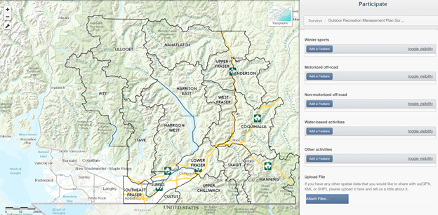
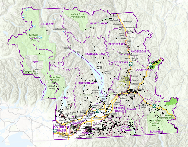
The data that is recorded by SeaSketch contains both a spatial aspect and a non-spatial aspect. The application has analytical capabilities as well as allowing the used to download individual or multiple data points for analysis. Cascade used the data to perform a custom analysis using ArcGIS software. The resulting data allowed Cascade to establish the following:
- Popular areas for specific activities
- Frequency of activity
- Areas with common issues/concerns

Share this entry